

Send, Papercourt and the Wey Navigation

A long nature walk with just about everything! (Including some steep steps)
Note: The path to the Marsh may close if the river bursts its banks. A diversion route is usually posted. See images of steep steps and stile. I have written to the Council to get these fixed 30/9/2022.
1. Park in the side road outside or near the shops on Send Road, Send at GU23 7EY (What3words /// punk.bounty.lined)
This is mainly free and unrestricted parking. Walk up Wharf Road on the opposite side to the very end, through the gate and join the path to the right of the big evergreen hedge. Continue onto the bridge over the canal. The bridge steps are steep but manageable with good handrails but not suited to bicycles or pushchairs. Turn right
- The walk along the canal is lined by rich vegetation including wild mint on one side and Phragmites reeds on the waterside, also, inevitably, a lot of Himalayan balsam. The area is bird-rich with warblers in summer with the likelihood of hearing cuckoo in spring.
- At the end of the Tannery buildings the walk turns right using the easy footbridge. Before crossing the bridge there is the option to visit Broad Marsh by way of a footbridge on your left. A short stop if you have binoculars is definitely worthwhile. It is a well-known place for birds of prey in winter including short-eared and barn owls plus hovering kestrels, buzzards and red kites most of the year. Stonechats and Linnets are likely to be seen here. Going back to the footbridge next to the Tannery buildings cross the canal and join the lane slightly left passing the car park. Follow the lane to where it starts to turn sharply left. Turn right to the footpath (do not pass Prew’s Farm Cottages).
- You will find a small stream on your left and farmland on your right. Continue on this path until you find a pond on your right - worth a look for possible kingfisher on a perch or at least moorhen and a few ducks. Keep right at a path junction and on reaching the old sleeper bridge turn left
- Follow this track all the way to a gate. On your left you will pass a plantation of native woodland, a recent field hedgerow and then Papercourt Marsh, a Surrey Wildlife Trust small wetland nature reserve. In summer you should hear the unmistakable sound of reed warblers from the Phragmites reedbed and ring-necked parakeet are common here. Many chiffchaffs feed here in late summer but the special bird with a distinctive call, now breeding here, is the Cetti’s warbler. If you hear a sound like a pig squealing, it is probably a water rail! The reserve is not open to the public.
- At the gate turn right into the lane and at the T junction turn left. Cross the road and join the grass path on the right-hand side passing the sailing club. You will be forced back onto the road for a couple of hundred yards before turning right at the footpath sign in the hedge – beware a trip hazard here.
- At the sign for the anglers car park keep left, follow the path to the right of the building and around the attractive lake edge. This lake has a good reputation for winter wildfowl. Birds like great northern diver may turn up here with little and great-crested grebes. A good selection of winter duck species may also be found. There are many good viewing points. The perimeter path provides good places to look for butterflies dragonflies and many wildflowers. Follow the footpath almost all the way around the lake. As you head towards the boatyard end of the lake the path splits, take the right hand option closer to the water’s edge.
- Now walk along a nice area of sandy grass land. There is a bench to rest on and a small area of heather providing a chance to find more species of butterflies and possible day flying moths. In late September, over the water, a number of swallows and house martins were feeding on insects. An assortment of gulls often rest on the jetty. The path turns left slightly and then the boat yard is on your right. At the corner of the boat yard turn left.
- At the next path junction, follow the footpath sign sharp right heading towards the road. On reaching the road turn right and look for a gate and the public footpath sign just a few yards along on your left-hand side.
- Follow this path keeping left of the allotments. At the end of the big field and the path T junction, turn left. Continue zigzagging over two footbridges onto a straight path between two fields. Where the path splits turn left and pass between two garden fences to the road.
- Turn right, then at the traffic lights, cross straight over. Turn left into Bush Lane it is also a public footpath. At the end of the houses follow the footpath with the tall metal fence on your right. You will pass school sports fields and paddocks on your left and some meadows on your right. You will reach a path junction where the concrete path goes left but continue straight on keeping to the right-hand side of the hedgerow. The path here had a great deal of wild radish flowering in late summer. When the open field ends on the left-hand side look for a path crossing the field to your right well before the big oak tree in the open field.
- Turn right along this crossing the middle of the field. When you reach the woods and a path T-junction turn left and follow this to the road.
- Turn right. At the next road junctions turn right and then carefully left into Church Lane. You soon reach Send church and it’s worth having a look at some of the old yew trees in the churchyard and maybe resting on a bench for a while.
- Turn right at the church along the signposted footpath. This quickly angles right as a track and then turn left immediately onto footpath between two fields. Herons and geese lifted off from the marshland as I walked this path. You will soon find the River Wey appearing on your left just beyond the hedgerow (see note above). Cross the river by the steep steps of the old concrete footbridge. The steps here are very high and steep, some shorter or less mobile walkers may find them difficult. Turn right along the river-side path. Cattle are often grazing here. The path soon turns away from the river and you will cross the marsh to the canal bank and another steep stile.
- Turn right. You will soon reach Triggs Lock so continue on the canal path to the right of the lock, cross the next bridge and into the field. Now it’s a longish walk along the delightful, picturesque canal bank and some National Trust properties to the New Inn pub and bridge.
- You may wish to stop here for refreshment, or just walk up to the bridge, turn left and turn immediately right onto the canal path the other side. Now continue along the canal until you reach the bridge (2) with steep steps close to where you started the walk. Cross the bridge and follow the road back to where your car is parked in Send (1).

View across Send Marsh to the church

Trigg's Lock
Starting point and conditions - 7.1 miles
Start in Send village where free parking is available outside the shops and in the side roads. Postcode GU23 7EY (What3words ///punk.bounty.lined). This walk is almost completely flat but there are steep steps across two bridges and very high steps on one plus one very high stile. Shorter people or those unable to manage a step upwards of more than foot and a half will need help. It will be worth the trouble. I am rating this walk Challenging purely for these steps.
Public transport
There is an hourly White Bus service 462 from Woking Railway station to Guildford Friary bus station 6 days a week (not Sunday). This connects with trains on the Woking to Basingstoke line and the Blackwater Valley line between Reading, Wokingham and Guildford
Maps
This walk can be found on the OS Maps app as BVNW Around Send and the Wey Navigation. Here is a GPX file.

Greylag geese
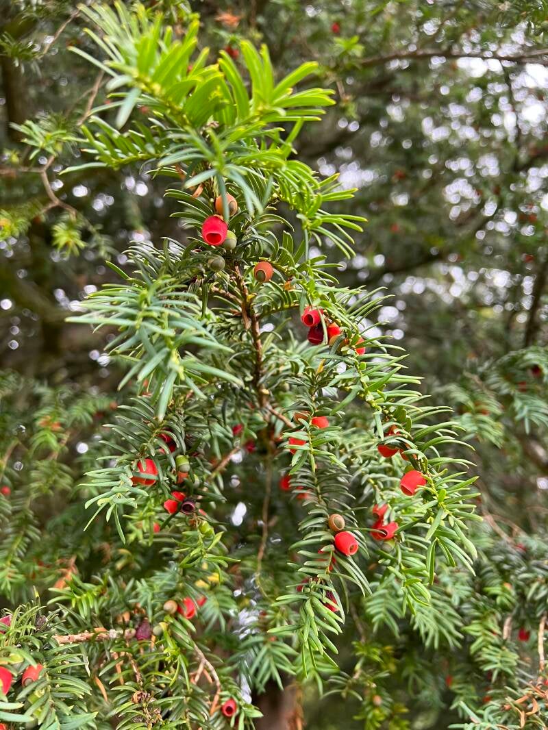
Yew berries in churchyard

Goldenrod

Male Stonechat-always perches high

Steep stile - more solid than it looks

Steep steps onto this bridge both sides - approx 46cms high